-
General assessment:
- Android versions:
2.2 and higher - Category:
Programs » Navigation - Developer:
DS Software - Languages:
Russian - The size:
19,6 МБ - Views:
53717


Polaris navigation system 9.23
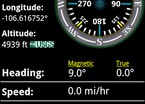
The Polaris navigation system is a complete navigation package that includes a panel for all standard GPS parameters, odometer, altimeter, speedometer, and directional compasses.
The advanced navigation features included in this huge set of tools include:
- Reliable point management system for setting up and finding your target.
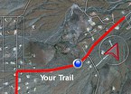
- Trail record and view Track records and store them in the trail database. The tracks can be viewed later or in real time on the antenna or standard maps.
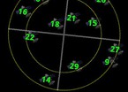
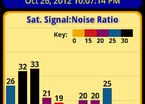
- Satellite reporting module shows location relative to GPS satellites to your position and graphs each satellite's signal.
- View waypoints, routes and your position on satellite and standard maps.
- The point guide system includes a dynamic point Revealing compass that helps you navigate to any point saved with confidence while reporting estimated arrival time, distance to the target and other statistics.
- Select the source of altitude reporting: Satellites, US Geological Survey or Mapquest's Altitude Service
- Turn-by-turn and route maps are included for navigating the roads.
- Data protection system, your data is backed up regularly means you won't lose your progress should the battery need to be replaced en route to your destination. The latest version of the translator Polaris navigation system download for android.
Download Polaris navigation system on android
- Program version: 9.23
- Downloaded: 563
- Comments from the site

- Minecraft 1.14.0.9
- Vkontakte 5.46
- Lucky Patcher 8.5.7
- VK mp3 mod 93/655
- Terraria 1.3.0.7.4
- VK Coffee 7.91
- GTA San Andreas 2.00
- Kate Mobile 53.3
- Pokemon GO 0.157.1
- Freedom 1.8.4
- Google Play Store 17.9.17
- VK App 4.0
- Sims 5.47.1
- Shadow Fight 2 2.0.4
- Last Day on Earth: Survival 1.14.4
- My Telling Angela 4.4.2.451
- Subway Surfers 1.113
- Dream League Soccer 6.13
- Geometry Dash 2.10
- Hungry Shark Evolution 7.0

