-
General assessment:
- Android versions:
2.1 and higher - Category:
Programs » Journeys - Developer:
Andrey Novikov - Languages:
Russian - The size:
9,0 MБ - Views:
16562 - Show all


Androzic 2.3
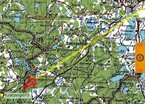
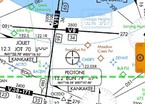
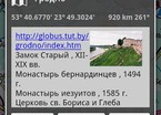
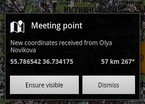
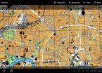
Navigation program using OziExplorer maps (ozf2, ozfx3). Designed for walking, geocaching, off-road driving, swimming and other outdoor activities. You are expected to get acquainted with OziExplorer or at least an idea of where to get cards in this format. Maps can also be created independently, but with some effort, see the details in the FAQ. It is possible to work without maps in the mode of a simple navigator. Works with a number of online maps, such as Open Street Map (requires an internet connection).
Application Functions:
• support for maps in ozf2, ozfx3 formats
• online card support
• work without maps in simple navigator mode
• track recording in the background
• navigation to the point and along the route
• converting a track to a route
• create and manage routes
• work with waypoints, tracks and routes in Ozi format
• loading points, tracks and routes in KML and GPX formats
• HSI and Compass
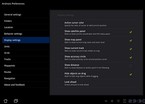
• customizable units of measurement
• UTM coordinates
• search for objects using Google Geocoder
• exchange of location and waypoints
• portrait and landscape mode
• tablet support The latest version of the app Androzic download for android.
Download Androzic on android
- Program version: 2.3
- Downloaded: 29877
- Comments from the site (5)

- Minecraft 1.14.0.9
- Vkontakte 5.46
- Lucky Patcher 8.5.7
- VK mp3 mod 93/655
- Terraria 1.3.0.7.4
- VK Coffee 7.91
- GTA San Andreas 2.00
- Kate Mobile 53.3
- Pokemon GO 0.157.1
- Freedom 1.8.4
- Google Play Store 17.9.17
- VK App 4.0
- Sims 5.47.1
- Shadow Fight 2 2.0.4
- Last Day on Earth: Survival 1.14.4
- My Telling Angela 4.4.2.451
- Subway Surfers 1.113
- Dream League Soccer 6.13
- Geometry Dash 2.10
- Hungry Shark Evolution 7.0
