-
General assessment:
- Android versions:
2.3 and higher - Category:
Programs » Navigation - Developer:
Chris Brossard - Languages:
English - The size:
7.3 MB - Views:
33850 - Show all


Trail Navigator 5.2
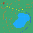
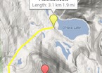
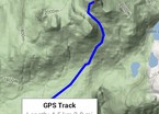
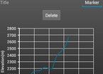
Find your way around in the wilderness with this navigation tool. View topographic (terrain) maps, place markers, plan routes, side view profiles, and record your movements across the country.
- To place a marker, click on the map
- To plan a route, long press on the map, then tap on your route, then tap on "record"
- When planning a route, long press on the map to delete the last point
- To enable GPS tracking, click on "GPS"
- To keep the route pointing up, click on "GPS" again (requires movement)
- To mark the current position, turn on GPS tracking and click on "Mark"
- To record your movements, turn on GPS tracking and click on "record"
- To view the marker information window, click on the marker
- To name or delete a marker, click on the marker information window
- Requires Google Play EXT
- Graphs created using the Snowdon Graph library The latest version of the translator Trail Navigator download for android.
Download Trail Navigator on android
- Program version: 5.2
- Downloaded: 6013
- Comments from the site

- Minecraft 1.14.0.9
- Vkontakte 5.46
- Lucky Patcher 8.5.7
- VK mp3 mod 93/655
- Terraria 1.3.0.7.4
- VK Coffee 7.91
- GTA San Andreas 2.00
- Kate Mobile 53.3
- Pokemon GO 0.157.1
- Freedom 1.8.4
- Google Play Store 17.9.17
- VK App 4.0
- Sims 5.47.1
- Shadow Fight 2 2.0.4
- Last Day on Earth: Survival 1.14.4
- My Telling Angela 4.4.2.451
- Subway Surfers 1.113
- Dream League Soccer 6.13
- Geometry Dash 2.10
- Hungry Shark Evolution 7.0


