-
General assessment:
- Android versions:
2.2 and higher - Category:
Programs » Social network - Developer:
Kolograph Inc. - Languages:
Russian - The size:
3.3 MB - Views:
3290 - Show all


PhotoTracker 4.0
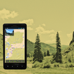
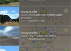
A program for people interested in tourism, travel and photography. PhotoTracker allows you to view photos linked to a map, taken by you and saved on your phone, as well as photos from popular Internet photo sites in a convenient form. In addition to viewing photos, the program provides automatic linking to the map of your photos taken with a conventional camera that does not have a GPS navigator.
Main features of the program:
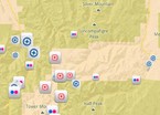
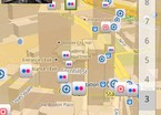
- View photos on the world map with geographical coordinates located on the phone, on flickr and panoramio sites with the ability to select only photos containing certain tags. Photos located on the phone and not having GPS coordinates are not shown on the map. This happens if the GPS service was turned off or there were no satellites in sight at the time of shooting.
- Displaying on the map about 150,000 interesting places from the wikimapia site that just dream of being photographed.
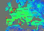
- Radar map for exploring the most photographed places in the world.
- Navigation to selected photos or interesting places using the standard navigation program of your phone.
- Maintaining a list of your favorite photos and uploading links to them in a convenient form for posting on your blog or website.
- Logging of your geographical coordinates in the database for linking to the map photos taken with a conventional camera.
- Uploading geographical coordinates in GPX format for further use in other programs.
Users who wish to connect to their flickr or panoramio account via PhotoTracker are provided with a number of additional features
- Display only your photos on the map.
- Automatic linking to the map of your photos (available only for flickr users). The latest version of the social network PhotoTracker download for android.
Download PhotoTracker on android
- Program version: 4.0
- Downloaded: 1627
- Comments from the site

- Minecraft 1.14.0.9
- Vkontakte 5.46
- Lucky Patcher 8.5.7
- VK mp3 mod 93/655
- Terraria 1.3.0.7.4
- VK Coffee 7.91
- GTA San Andreas 2.00
- Kate Mobile 53.3
- Pokemon GO 0.157.1
- Freedom 1.8.4
- Google Play Store 17.9.17
- VK App 4.0
- Sims 5.47.1
- Shadow Fight 2 2.0.4
- Last Day on Earth: Survival 1.14.4
- My Telling Angela 4.4.2.451
- Subway Surfers 1.113
- Dream League Soccer 6.13
- Geometry Dash 2.10
- Hungry Shark Evolution 7.0
